How Important Are The Surveys And Why Are These Needed?
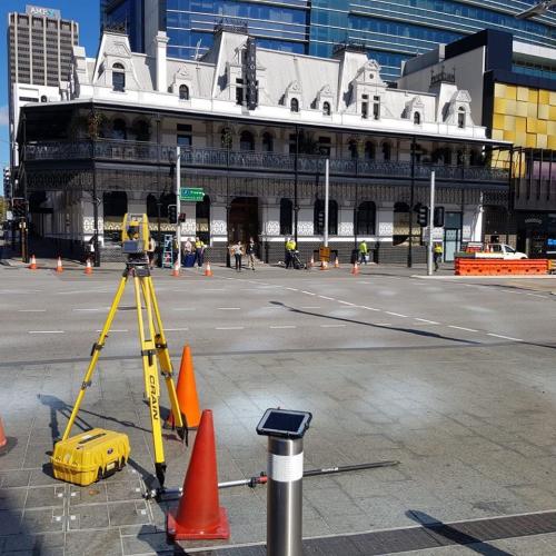
The drawings produced by the licensed surveyors document the property lines' exact locations. Knowing the correct location of property lines is compulsory when you have decided to construct a new structure or add a new one to the existing construction.
To meet your plans of extending your kitchen into the backyard, you will have to be clear about whether you are permitted to get the addition constructed in the available backyard space. The licensed surveyors in Perth can determine the location of property lines, while the architect uses the drawings for determining the distance your house should be from each property line. This is termed a setback.
Different setbacks are applicable to different zoning classifications and different cities for decks, buildings and garages from rear property lines and front side. Setbacks are necessary for steep slopes, bald eagle nests, wells, septic tanks, streams and more. Only the licensed surveyors working in Perth can document everything with accuracy so the construction project is done legally according to city laws. At the day's end, you won't like an inspector blasting the home since it has been built so closer to property lines.
A Myth To Expel –
- The fence is not the property line
- The sidewalk or the curb is not the property line.
- No rock by any tree can be on the property corner.
The building department will not at all entertain your thoughts about your fence, and whatever your neighbours have informed you. The only legal document to determine and prove the location of property lines and how far the house is located from the property lines is a survey report done by surveyors. Using the survey drawings, the architects can get exact information about where should they start the project design. The surveys guide the building department to approve the drawings to issue the construction permit.
Documenting the lot coverage is another reason why a survey is needed. Lot coverage means the percentage of property permitted to be covered by decks, buildings, patios and the combinations thereof.
A surveyor exactly locates the locations of each of these items on a property to help the architects calculate the amount of surface area for each item. The architect needs the exact size of the existing house, shed, garage, deck, and trellis to be sure the maximum lot coverage has already been exceeded or not. This information is very much important to be certain about the remaining area to be utilized to cover a bigger house.
In fact, the surveyors have the responsibility to document trees and topography, that is land slope. This is of higher importance since a few restrictions are there on removing a few trees, and setbacks are needed for some trees to suck up the rainwater for preventing the sewer systems from being overburdened by the stormwater runoff.
The architects have to know the land slope for designing an appropriately fitting building into the hillside while not requiring excessive soil excavation and removal as it is expensive.
A few slopes, additionally are classified as "steep slopes" when they are exceeding a certain height or slope percentage. In fact, the architect should know the exact top and bottom of the slope's location. The needed setbacks or buffers from the slopes can be maintained with the new construction project. Surveyors also document the house's height limit. To determine this, the surveyors have to know the land topography as the maximum height limit is found by calculating the ground's average height.
The surveyor even has the responsibility for documenting easements. There are certain property portions that are used by somebody else other than the property owner. Say, when a neighbour is having a drain pipe going through your yard, but an easement has been documented which is against building within that area. This is important information for the architects to smoothly design a project.
Indeed, surveys are much valuable investment enabling the architects to properly design a project while keeping compliant with the land use codes. From the surveyors, the architects receive a PDF file as well as an AutoCAD file for working with 100% accuracy on the computer. Architects require a survey with clearly drawn property lines and the perimeter of the prevailing structures. There are most cases where trees, easements and slopes have to be documented for the architect to determine the necessary setback, maximum lot coverage calculations and height limit.
Advertise on APSense
This advertising space is available.
Post Your Ad Here
Post Your Ad Here
Comments