Which Components Make a Complete Boundary Survey?
When you are a property owner, you will have to know where the boundaries are located. Clear boundaries and maps are the saving shields for the future. Arguments would be stopped before arising – be it for private property, commercial property, land mining or land drilling. Landowners have to commission a boundary survey to solve the conflicting views related to boundary lines.
What Is Meant By A Boundary Survey?
A property's boundaries are formally defined by a boundary survey. A boundary survey defines the corners of a land parcel. Generally, before purchasing, dividing, renovating or constructing on land, land surveys are commissioned.
Upon the completion of a land survey, the land surveyor creates a drawing. The measurements are to be absolutely error–free and exact, so the trained and qualified land surveyors licensed in Perth are hired for the purpose. The drawings are of –
a. Lot Dimensions –Deeds, subdivision plats and survey drawings define the lot dimensions, which show the property’s exact lines.b. Improvements –The boundary surveys consist of the improvements done by the previous owners on the land, in the form of sheds, garages, houses, pools and similar permanent changes to the property.c. Fences –Fences indicate the property’s location. However, the fences are rarely constructed directly on the property lines. Fences are included in the drawings. Still, these are not to be considered as the property’s outlines.d. Easements –Easements are included in the drawings when the boundary surveyors have a title commitment copy.
The Components Completing A Boundary Survey
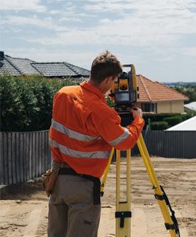
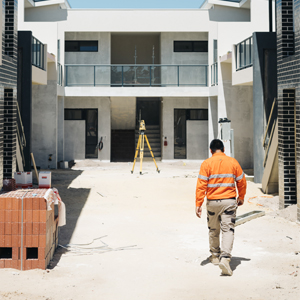
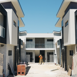
Boundary surveyors take specific steps to complete the actual boundary survey comprising the necessary components.
i. Registry search is the foremost component of a boundary survey. A boundary surveyor extensively conducts research in the county registry of deeds since successful information requires the deeds' information.Public and private research is necessary for effective boundary surveys for fulfilling the registry deeds information, which was not accumulated from the registry of deeds.Private and public researches come from varied sources, which include municipal offices, historical societies, other land surveyors, state agencies, and information from the abutting land's owner and county commissioner's office.ii. The boundary surveyor prepares the deed sketch after completing the sketch. The surveyor creates a worksheet identifying the record calls along each boundary line. A number of boundary lines contain several distances or calls over a long time, which is why research is so important in boundary surveys. Research has to ideally work with the original deed since it is the best way for showing the intentions of the property's original granter.iii. The field resonance is the boundary survey’s largest component. While conducting the fieldwork, the surveyors work at exploring the property and marking the corner. This is how they collect all the needed information essential for completing the drawing.iv. Once the field reconnaissance is done, the boundary surveyor starts analyzing the data. They review, validate and verify the mathematical accuracy of the data. At the time of the survey process data entry and analysis component, the boundary surveyor determines the encroachments, acreage, easements, corner locations, direction rights and all other different aspects.v. The data entry and analysis completion marks the stages for the surveyor to start the final plan that consists of the results of all final findings and recommendations. Generally, the plan is prepared to the standard for the other co-land surveyors to verify the findings. The plan is the legal document insured and prepared in compliance with the state Board of Licensure’s requirements.vi. Visiting back the property’s site is the final component. The boundary surveyor clearly marks the property corners and lines for the property owners. The markings are the sign to people about the land being officially surveyed.

The registered and licensed boundary surveyors have the legal right to survey the boundaries and for their improvements. They are responsible to define the property boundaries accurately and understand the land ownership laws. This includes identifying the residential and rural boundaries, boundary re-establishment which were surveyed previously or creating new boundaries as a part of the land subdivision process.
Advertise on APSense
This advertising space is available.
Post Your Ad Here
Post Your Ad Here
Comments