What Will be Shown By the Surveys as Done By the Licensed Surveyors?
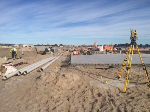
After a survey is completed, then the property corner will be marked with bright coloured flagging in the field. You shall receive the survey's map or plat as the licensed surveyors have conducted. The surveyor will sign and seal the map to make it an official copy containing abundant information regarding the property.
Boundaries
The physically marked boundary lines in the field will be represented as the heavy lines and will be having descriptions of the actual corners. Usually, these corners will be iron pipes, concrete monuments, or iron rods and even axles to creeks, rock cliffs or trees.
Labeled with distances, bearings or curved data, the boundary lines form the data showing the lines’ lengths and direction. These data are equally necessary for calculating the property’s acreage, which will be shown on the plat’s face.
Ownership and Easements
Added to the shown boundary information, you will be seeing the adjacent land owners' information along with the rights-of-way and easements affecting the property. As surveyed by the licensed surveyor for given land in Perth, the survey will show the adjacent landowner information through the Parcel Identification Number, the current owner of the property, as well as the recorded deed information.
If available, then the rights-of-way information will be shown with the width along with the improvements done to that right-of-way, like the sidewalks and paved roads.
Delineated by the dashed lines, the easements are shown on the survey. Easements are not said to be the ownership, but these are the "Rights" meant for a specific use. A 10 utility easement on the property, is an example of an easement. Through this easement, the utility company can have the right of access to that property's easement for maintenance, improvement or for utility installation. Since they are having this right, the homeowners are not allowed to restrict this very access by getting any improvements constructions done on the easements.
Improvements and Encroachments
The map shows the property's all physical improvements, which include the house, shed, barn, driveway fencing and the other permanent improvements to the property. Most of these improvements are dimensioned and contain ties to the boundary lines. Now, these ties are equally important, since restrictions often exist on how close certain structures should be to the boundary lines.
The map will also be showing the encroachments, which are the improvements constructed by one party on the other's property, or non another easement. For instance, a neighbour fencing his property and thinking it is fenced, but the fenced area actually contains some of your property's portion, or else vice versa. Encroachments could be anything from a walkway to some portion of the house. These encroachments are labelled and dimensioned on the survey for dealing later as needed.
A licensed surveyor, owing to experiences and updates, will be using the tools and inputs to conduct the needed surveys with clear markings. Each marking is a guide to the owners to decide for subdivision and title establishment, which later helps in avoiding disputes and contradictions. Hence, if you are unable to figure out the surveyed map, make sure to talk to the surveyor.
Advertise on APSense
This advertising space is available.
Post Your Ad Here
Post Your Ad Here
Comments