What Are Utility Locating Services Types for Site Surveying in Perth?
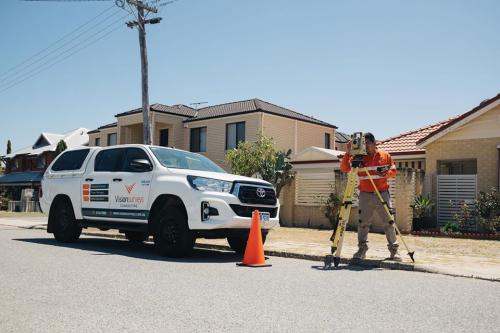
Utility location has a huge role to play in construction projects. The subsurface utilities including gas and electrical, telecommunications, plumbing, and pipes are widespread throughout Perth. So, at the time of site surveying, the surveyors make sure to know the underground before they are digging.
Even, the process is extremely crucial in new properties design and development since the placement of existing structures should be known for designing a brand new structure accurately. Since you are the owner, you have to know the methods for saving time and money. So, it is a must for you to get in touch with the qualified surveyors providing site surveys in Perth. The site surveyors have the capability to locate all the underground utility services at a much early designing process.
The method on which the site surveyors rely for locating utilities in Perth is further covered in this discussion.
i. Radio Detection
Through radio detection, most underground services are located. This method is beneficial particularly to find out the electrical as well as the metal-based services. Even the construction projects benefit from radio detection. The foremost advantage of radio detection is it does not cause any damage to the electrical services and is thus much useful for simple jobs such as backyard digging.
ii. Ground Penetrating Radar
The most effective and efficient scanning methods employed in site surveying are ground penetrating radar or GBR. GBR sends millions of frequencies straight into the ground and thus helps in providing a detailed accurate map of all the underground details.
Different from radio detection that picks up the conductive services, GBR has the capability of generating visual data of every underground object. As a result, it is helpful in locating clay pipes along with the other items which are usually not picked up by means of standard radio detection.
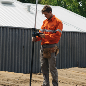
iii. Concrete Scanning
Concrete Scanning is a vital part of construction projects, especially while work is going on for the prevailing concrete structures. The ground-penetrating radar technology is used by the surveyors to scan since it is non-invasive and totally accurate.
Scanning is extremely crucial when the main concerns are drilling, cutting, and coring the already prevailing concrete slabs. The surveyors can then locate the objects like pipes, conduits, cables, and rebar; and they can even conduct slab thickness assessment. Its ultimate outcome is the damage risks to the concrete structures are significantly minimized. Even the workers working at it will undergo least or no injuries.
What Makes Utility Mapping Much Essential for Site Surveying Purposes in Perth?
Utility Mapping, in the first place, helps in reducing delays and eases out the construction projects. Once the utility information is complete and accurate, then you can go ahead with planning your constructions accordingly. Added to it, it is a must for the construction to avoid any impacts on the surrounding buildings.
If the underground services undergo damages then its adjacent structures will be affected equally, and in worst cases, the damages might go further. Hence, utility mapping is highly essential before any digging activity is taken up. At the same time, when all the information is secured regarding the underground details, then minimizing the safety risks to the workers will be possible.

The Property Boundaries Proof
For showing the property ownership extent, the basis is often the marked boundaries – in the form of hedges, fences and walls. But in reality, it is insufficient in accurately describing property ownership. There might be a construction or an excavation activity already encroaching on the other person’s property. But depending only on the reworks and demolition and beginning fresh might is likely to be expensive.
So, getting things done right from the beginning is imperative. Apart from fulfilling the required obligation, determining the land boundaries helps in making accurate developmental planning. This is where the boundary surveys for the development projects in Perth are necessary. It could be a commercial, residential, and government construction project where knowing the property ownership extent helps in providing insights on the best way for project execution.
To accomplish this, the registered land and boundary surveyors take over to establish the true boundaries of the property. Along with fences, walls, hedges, and the other marks that might not exactly describe the extent of the property, the land measurements on the grounds are even not reliable, consistent and accurate. So, the land measurements have to be adjusted as long as the slope is present. The horizontal distances will not be the sole basis. The other methods, like making use of the handheld Global Positioning System or GPS devices are not likely to give the necessary accuracy as well as the precision level and the measurements are likely to vary.
The registered land surveyors make use of their expertise for acquiring the best evidence on the boundaries' true locations and determines the relative positions of the points above, on, and below the surface of the earth. The method is a complete and 3-dimensional approach giving the results for better planning for the land in the subject.
Advertise on APSense
This advertising space is available.
Post Your Ad Here
Post Your Ad Here
Comments