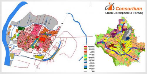
Check Out How GIS Is Applied On Urban Planning

GIS
is a technology that is used to analyze the urban growth and its direction of
expansion, to determine suitable areas for further development projects. In
order to identify the suitable sites for urban growth and development, certain
factors need to be considered, which are: land should be more or less flat,
land should have proper accessibility, land should be vacant or having low
usage value currently with a good water supply. GIS has been used in multiple
industries and a GIS company India can play a crucial role in it.
Geographical
information, when integrated with remote sensing, can save a lot of time that
is spent on collecting land use and environmental information. Remote sensing
images are becoming an important source of spatial information for urban
planning projects. They can help in detecting land use, and land use changes in
urban areas. In particular, stereoscopic pairs of digital aerial photographs
can also be used to derive 3D CAD models of the building which facilitates dynamic
visualization of a city. GIS companies in India can help to store, manipulate
and analyze social, physical and economic data of a city. Planners then use the
mapping functions and spatial query of GIS to analyze the current situation of
a city and also determine the areas of conflict of land development on land
suitability maps. This data and analysis are then used to take important
decisions that affect the current and future planning of an area.
Modeling and Projection
One
of the most important functions of planning is the projection of future
population and economic growth. GIS can be used for projection as well as
prediction. Spatial modeling of spatial distribution makes it possible to
assess the impacts of the existing population and other economic and environmental
changes. For instance, a range of environmental scenario can be examined
through GIS map overlay analysis and to find areas of conflict. Using
environmental and socioeconomic data stored provided by GIS company India,
environmental planning has just reached another level.
Development of Planning
Options
Land
suitability maps are quite useful in the planning process. They can be used to
identify the solution space for further development. Integration of spatial
optimization models with GIS can also help in designing and developing planning
options which can maximize or minimize specific objective functions. The
simulation of different scenarios of development with GIS can help in
developing effective and feasible planning options.
Selection of Planning
Options
The
final selection of planning is actually a political process, but planners can
always provide technical inputs to this process in order to help the community
understand the technicalities and make a collective decision. The integration of
non-spatial and spatial models with GIS can help to evaluate different types of
planning scenarios. The data provided by GIS and its subsequent analysis can be
used to make informed decisions.
Plan Implementation
GIS
can be used in the implementation of urban plans by conducting environmental
impact assessment of the proposed project and minimize the environmental impact.
Following such work, remedial measures can be taken to eliminate these impacts
and GIS will come in handy in ensuring the same is achieved.
Post Your Ad Here
Comments