How Are the Property Lines and Their Distances Determined?

The corners' location in the property is defined as the property lines, and this is how the licensed boundary surveyors determine the property lines -
- Locating the survey monuments at the house’s each corner
- Using a loop, tying the string to one monument and extending it at the line’s opposite end to the monument.
- Pulling the teaching line between the corners for creating the “Line”.
Although this method legally decides the property line’s location, yet the court system will understand that it is not necessary the straight lines between two points will define the property line. In fact, they keep up meandering lines on the rural properties where the old fences are zig-zagging through the trees, rivers, brush lines etc. Not the straight line between the two points, but the fences were determined to be the property line.
Nevertheless, in the urban and suburban scenarios in Perth, it can be reasonably concluded that the property line is the straight line between the two points.
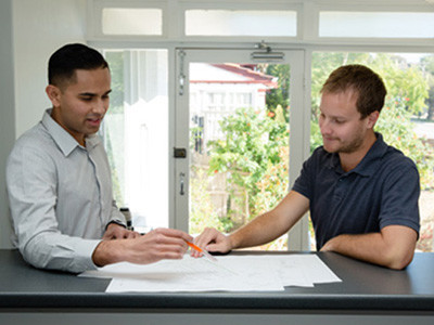
Now the difficulty is at locating the land’s corners and finding the property’s corners for deciding the property lines. So, it is a must to hire a licensed surveyor from the well-known surveying firm in Perth for identifying, locating and checking the property's corners to ensure you know where your property line is located.
8 Ways for Determining A Property Line Distance
While certain ways cost money, whereas there are ways involving efforts for determining the distance of the property boundary line. The distance of the property boundary line is said to be the length of the line usually expressed in units of feet.
Here is how the property line distance is determined.
I. By Reading the Property DeedBy having access to the property deed, it will be easy to find the property line distance, and you should have this if you are owning the property.To determine the property lines’ distance you have to read through the deed, find the parcel of land’s legal description and read the distances of the property’s boundary lines.II. By Reviewing the Property Plat MapBeing the property owner means you have received the property plat map at the property purchase closing, This map shows the various information about the property including the labels for the distances for the property's each side. Most likely, each of these labels will be located right along the corresponding property boundary line with the line and label text with the same orientation.III. Reviewing A Survey Boundary MapA survey boundary map is created for the present owner or the previous one in need of an official plan showing the boundaries and property layout. This map shows the distance for each boundary line.IV. Using An Existing Conditions PlanAn existing conditions plan is the survey plan prepared by a professional licensed surveyor for a site when the base plan created for the site plan's design will be needed for a new addition, new building construction and other proposed land development. This plan even shows the distances for the property's sides.V. Utilizing the Local GISAt present, many municipalities must be having an online Geographical Information System or GIS set up to display immense information regarding the land in the municipality’s region. So, assuming your Municipality is having a GIS, you will be able to locate your property and use the tool available within the GIS website for measuring the property's sides. Be boundary lines could even be labelled within the system.VI. Hiring the Licensed Surveyors of Professional Surveying CompanyHiring a licensed surveyor from a registered surveying company for creating a boundary plan or an existing conditions plan is the needed step in planning a land development project for your site.VII. Using the Pacing For MeasurementsPacing is the option to make a quick estimate by measuring the distance using your steps. Hence this method is not of exact accuracy. One of the steps' length is measured and the number of steps counted is needed for walking the distance for one of the property boundary lines. Then the number of steps will be multiplied by one-step length for calculating an estimated number of the measure property line for the total distance.VIII. Using A Measuring WheelA measuring wheel is a device needed for measuring the distances over the land. To measure the property line, starting is done from one end and the wheel is rolled over to the other end before the distance is read off of the measuring wheel.
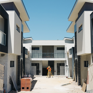
As discussed, there are many ways to determine the property line distances, and the best of all is hiring licensed surveyors. They prioritize accuracy, and their work will bring out the exact result. Using the accomplished methods and professional tools, they will ensure to follow the legal steps and bring up the outcome coded with rules.
Advertise on APSense
This advertising space is available.
Post Your Ad Here
Post Your Ad Here
Comments